Good afternoon everyone!
This week we’re expecting not only some rain but also much cooler temps as a front moves through the area.

NWS-Nashville #tSpotter Partner. VERIFIED/CERTIFIED Graduate Storm Spotter and WRN Ambassador for Rutherford County. Use #tSpotter to report to the NWS.
Good afternoon everyone!
This week we’re expecting not only some rain but also much cooler temps as a front moves through the area.
Good afternoon everyone!
We have some rain making its way across the MidState this afternoon.

Good afternoon folks!
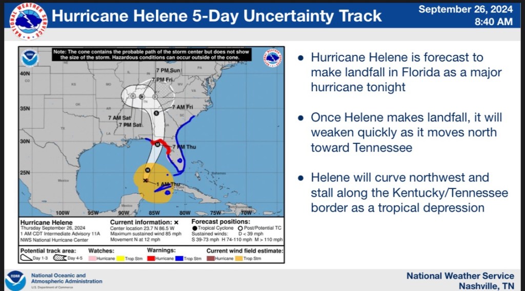
Here is the current forecast for Helene as it makes her way towards us. First. This is what we’re expecting this week for rain chances.

The current track (could change as updates happen) for Helene brings her right into middle Tennessee. We could see some heavy rain and high winds as this storm moves into the area.
The wind gusts we could experience are around 20-40mph gusts.
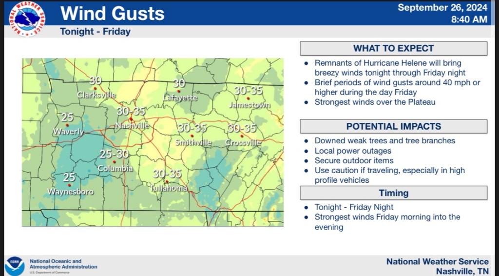
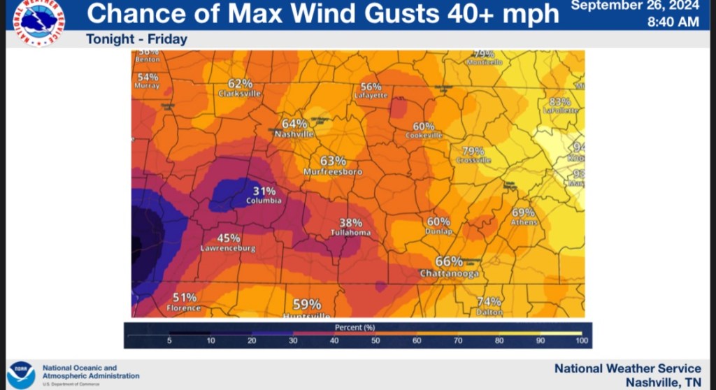
The chances of us seeing those gusts are around 60%. Which means we probably will have some heavy gusts of wind.
And we currently have a flood watch for the entire area. Starting tonight through Friday night.

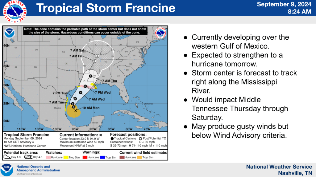
Hi there everyone! Newest update shows a system that could develop into a hurricane this week and the remnants could affect us this weekend.
First off. We can possibly expect some off and on rain today. (Pop up showers actually in the area right now)

Tomorrow we have a higher chance of rain in the area.

We have an even higher chance of much needed rain making its way into our area Wednesday.
And as of right now this is the path of the next tropical system in the gulf right now. The track shows the rain making its way through the area this week and the center of the low making its way into our area Friday and Saturday. As these update. I will update everyone.

This week has been crazy so far. Cloudy. Low temps. But all that is about to change.
Starting tomorrow we’re going to be in the upper 80’s and we’re expecting to see some 90’s this weekend. We’re not expecting to see any rain for the next 7 days but if that changes I will let yall know!
Good morning all!
Francine officially became a Category 1 last night. There is a chance for her to become a Cat 2 before she makes landfall this evening.
The NWS in Nashville put this out overnight. Francine is still on track to come into the state starting tomorrow. The outer bands and remnants will start to impact us tomorrow through the weekend.
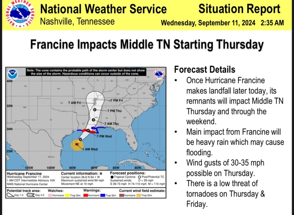
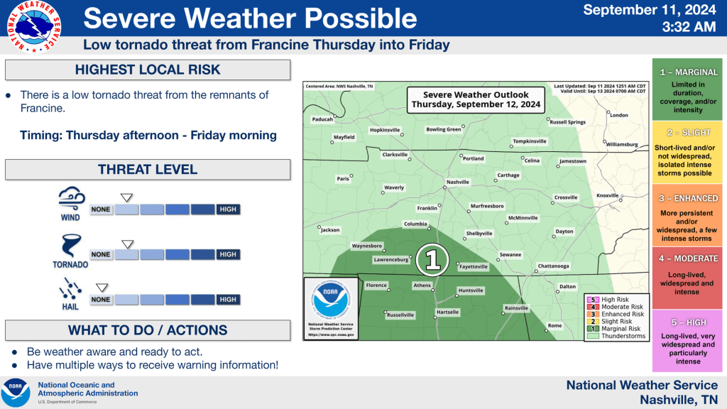
We are possibly expecting some severe weather as these bands move through the area. We do have a low threat for tornadoes but the highest threat right now will be flooding. Especially in low lying areas and flood prone areas.
We’re expecting about 3-4inches of much needed rain making its way with this system moving in.

We can also expect some wind gusts tomorrow as Francine moves into the area.

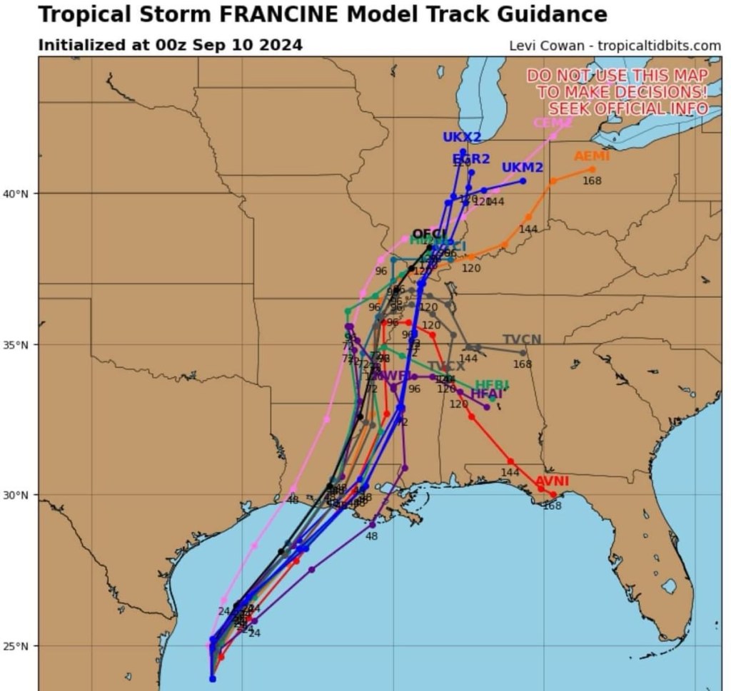
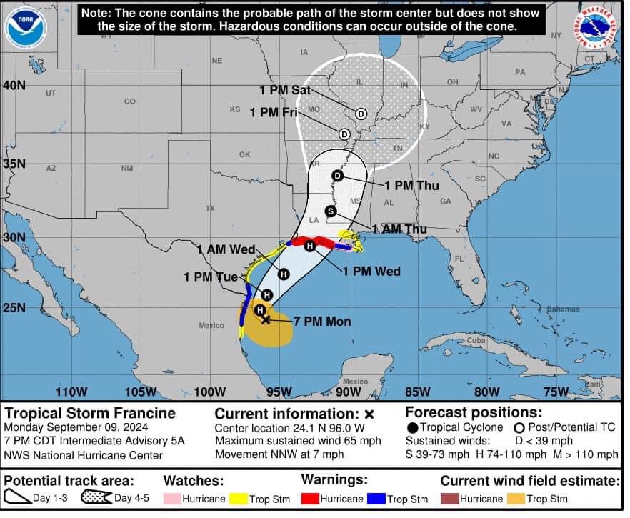
The hurricane center has put out a new outlook for tropical storm Francine.
We’re seeing a lot of models tracking the same way bringing Francine through Louisiana and up the Mississippi River into the west Tennessee area. This is just where the center of the storm is going. That isn’t going to show the width of the storm. We could expect 1-3 inches of rain as this moves into the area the end of the week/weekend.

Good afternoon folks!
As you’ve probably already seen, there was a new tropical development that formed in the Gulf over the weekend and now is named Francine.
We’re expecting that this could make its way into Tennessee the end of the week/weekend time frame. The NWS and Hurricane Center is predicting that it could reach our area as late as Thursday evening through as late as Saturday. Will keep you updated on the development as it comes in!
Hi there all! We can expect to see off and on showers happening today with a high in the upper 80’s.
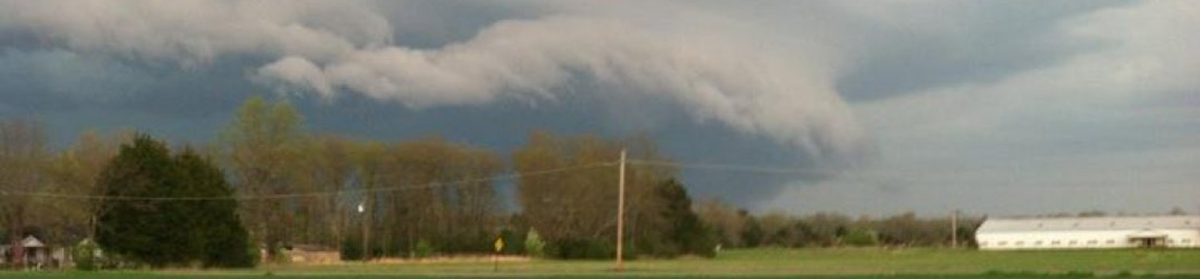
welcome to the first annual MboroSevereWx blog post!
Im so excited to have this baby up and running finally and I can’t wait to see how this turns out. Thank you to everyone who has helped me make this possible.
