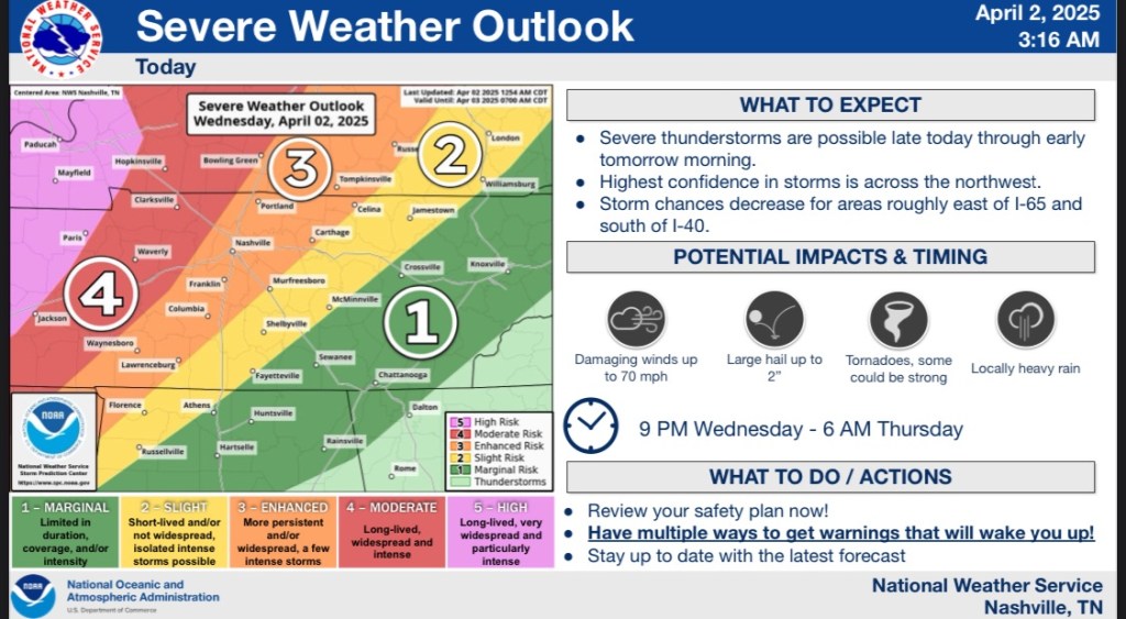
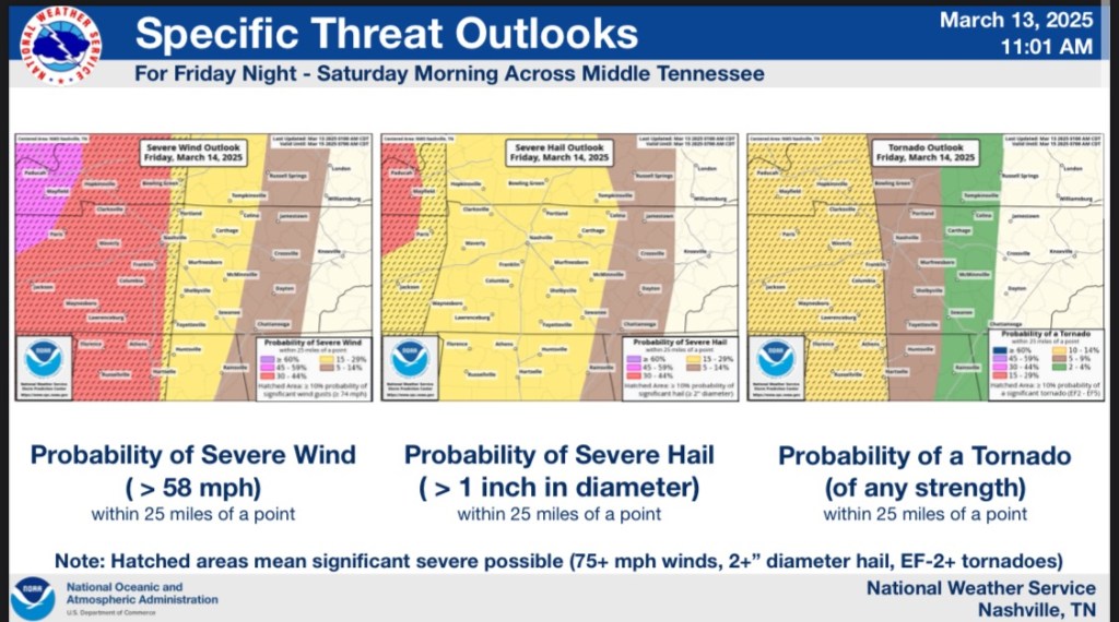
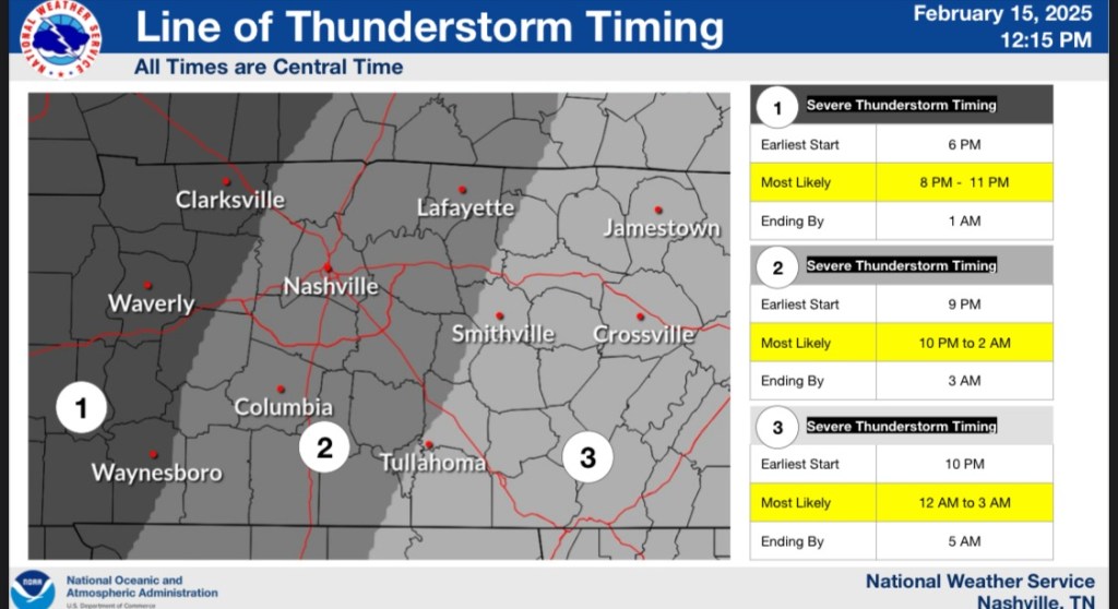
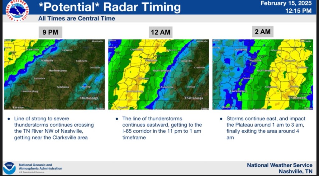
Alright folks. We have some severe weather heading our way. Our area is under both a slight and an enhanced risk for severe weather tonight into tomorrow morning.
Tornadoes are on the table, as well as hail, wind, and flooding.


NWS-Nashville #tSpotter Partner. VERIFIED/CERTIFIED Graduate Storm Spotter and WRN Ambassador for Rutherford County. Use #tSpotter to report to the NWS.
Alright folks. We have some severe weather heading our way. Our area is under both a slight and an enhanced risk for severe weather tonight into tomorrow morning.
Tornadoes are on the table, as well as hail, wind, and flooding.
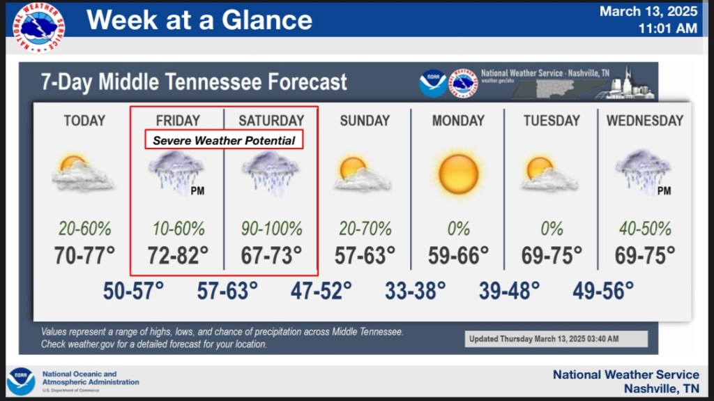
As we move closer to this weekend the severe threat for weather coming in.


Good morning everyone!
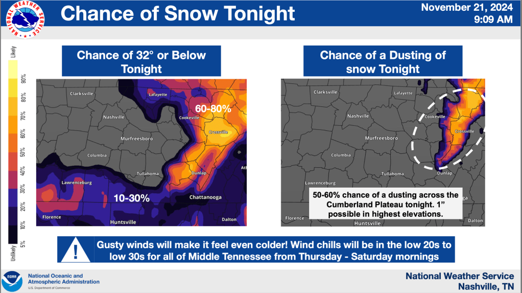
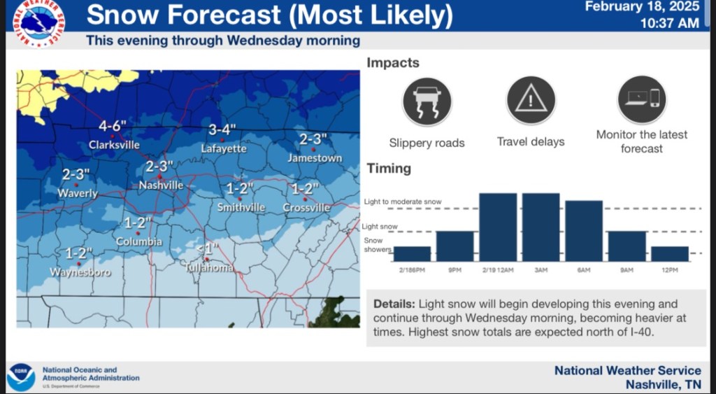
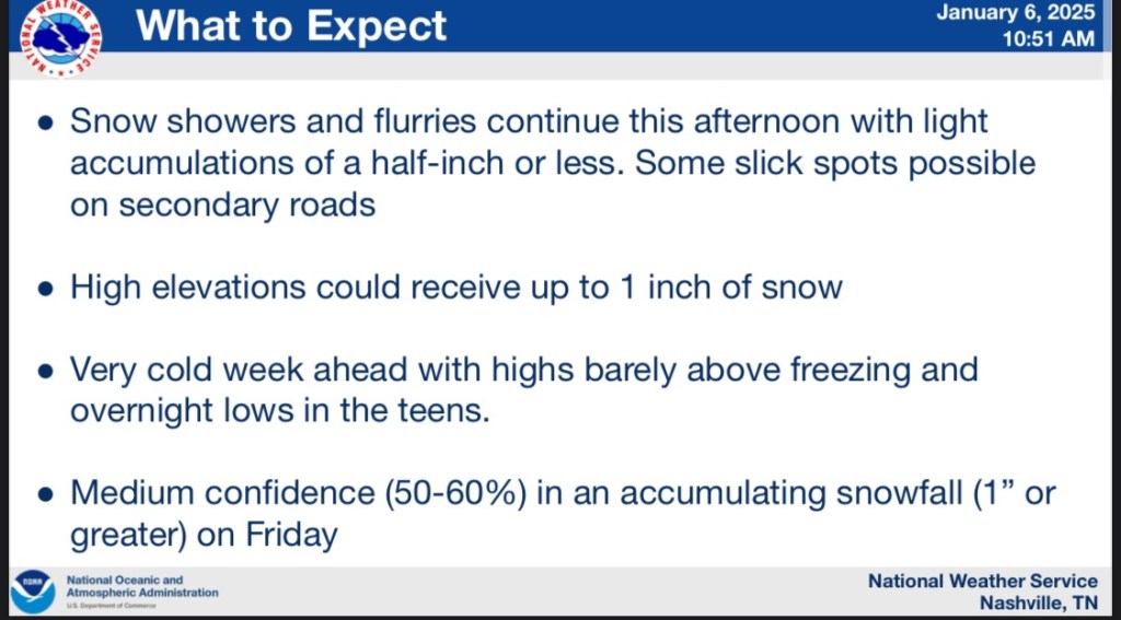
We have updated talks about the snow tonight into tomorrow.


Good afternoon everyone!
I hope we all had an amazing weekend. I know that just a couple of days ago, we were talking about highs in the 60’s and storms. Well now we’re here to talk about the snow 😂. Good ole Tennessee.


Good afternoon everyone.
We’re looking at the potential for some strong storm to come through this evening through the overnight hours.
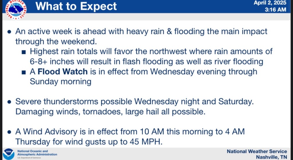
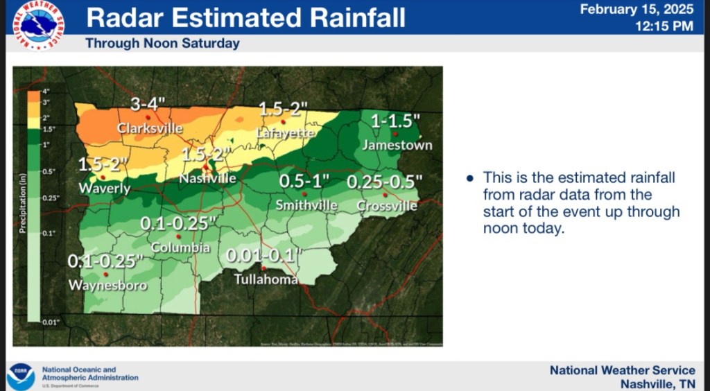
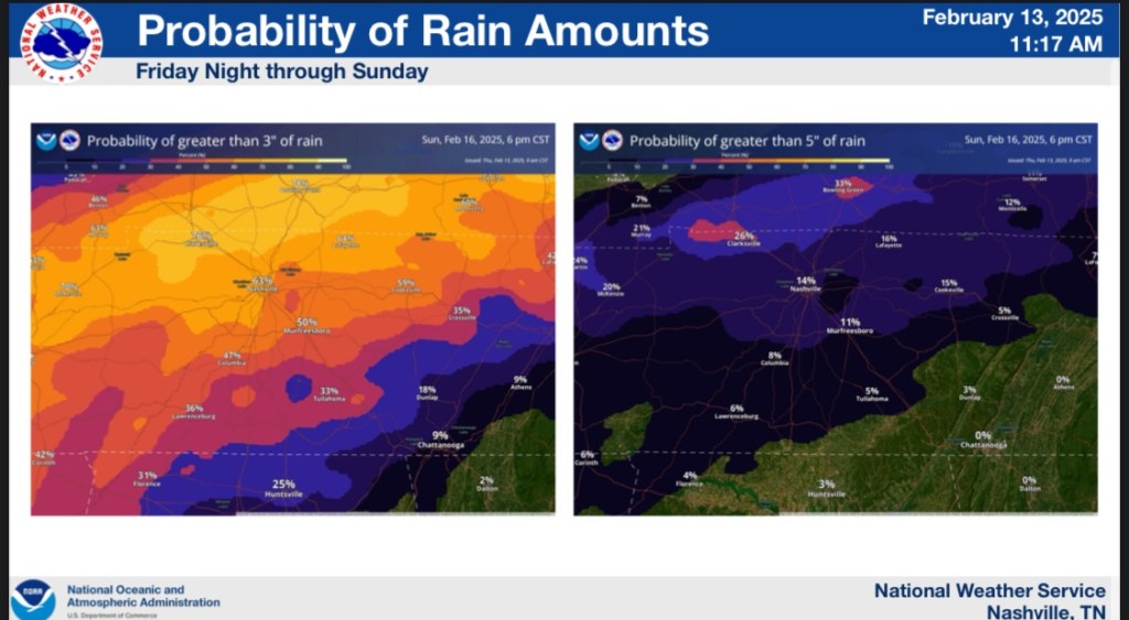
The latest threat for the rain that’s coming in is the flooding concerns. We’ve had so much rain over the past few days that the ground is saturated. We’re expecting another 1-2 inches of rain with this line pushing through tonight.

Hey there! Here is what I gathered from the briefing.


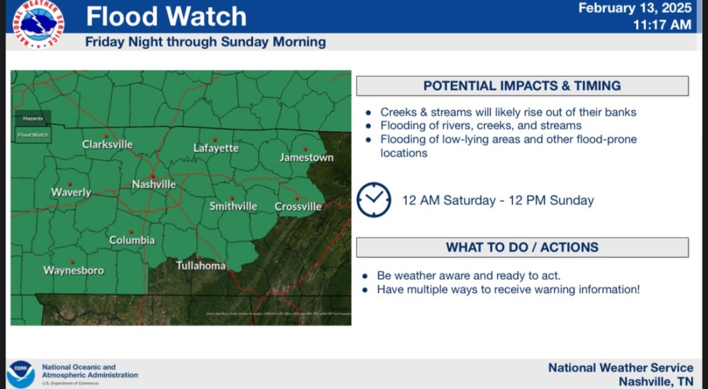
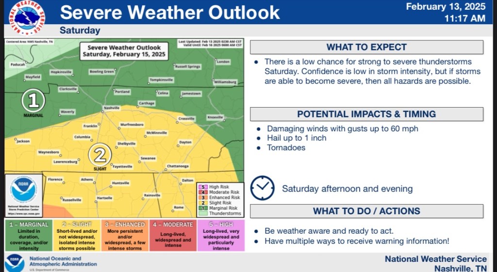
In summary. We are expecting a lot of rain. Possible flooding and some possibility of severe storms Saturday.
Good afternoon all! Thank you so much for your patience.
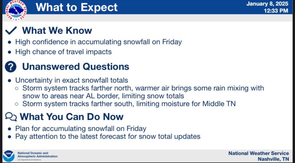
What we can expect for this upcoming snow that will make its way into our area Friday morning.
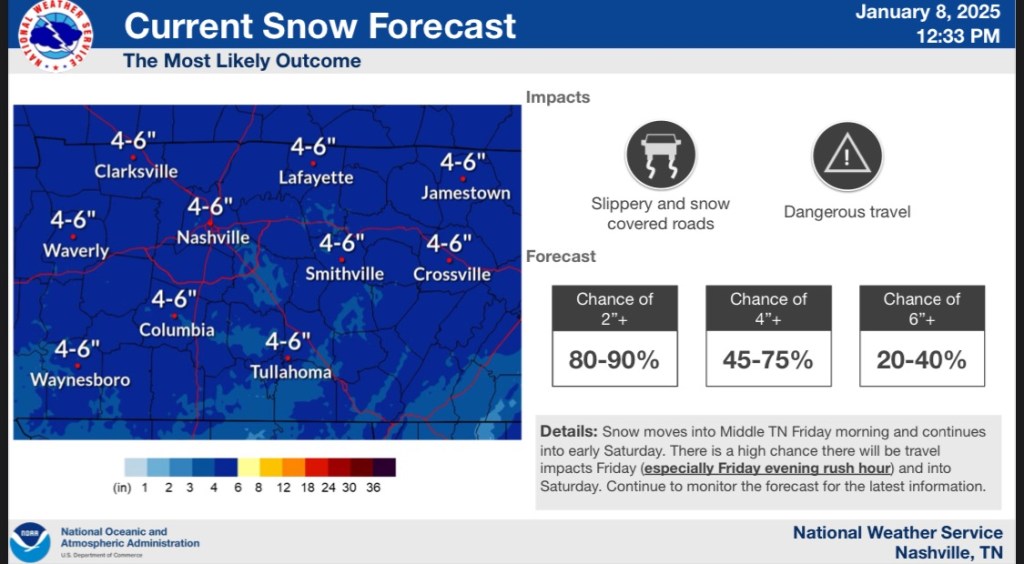
Currently, the NWS is confident that we’re going to get 2+ inches of snow Friday. There is a chance of us getting 3-6 inches of snow by the end of this.
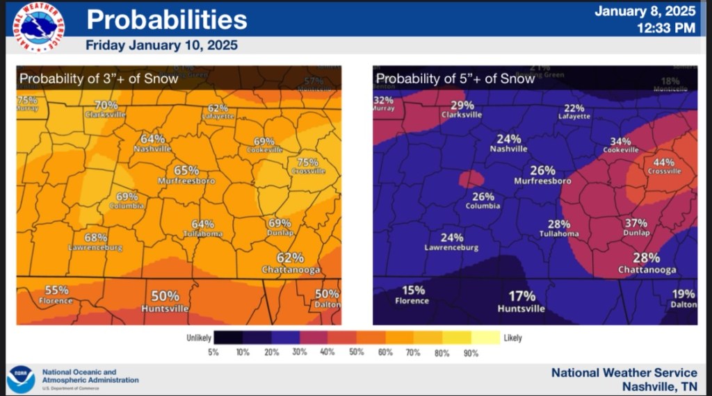
We’re at a good 65% of a chance of 3” snow for our area. There is a chance of 5”+ of snow but that chance is around 25%-30%.

The timing of the snow. We’re looking at it starting to come into our area around 7am-10am. We could see it earlier but that is the best timing we could see.

A more breakdown of the timing for Friday is this. Light snow starts and as the day wears on, we will see heavier snow happening. It will taper off and should stop snowing around Saturday morning.
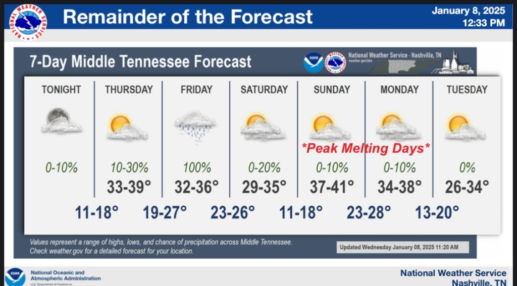
When the snow starts Friday we will have low chances of seeing melting before Sunday into Monday. The next 7-10 days we will have cold temps happening for our area.

Good afternoon everyone!
It has been off and on snowing today! Yay!!! (I love snow)
The high of 53° yesterday will the the last day we see mild temps for at least the next 7-10 days.
We have a chance of snow happening on Friday (happy birthday to HickmanSevereWx for that one!) the NWS sees a good possibility for snow happening.

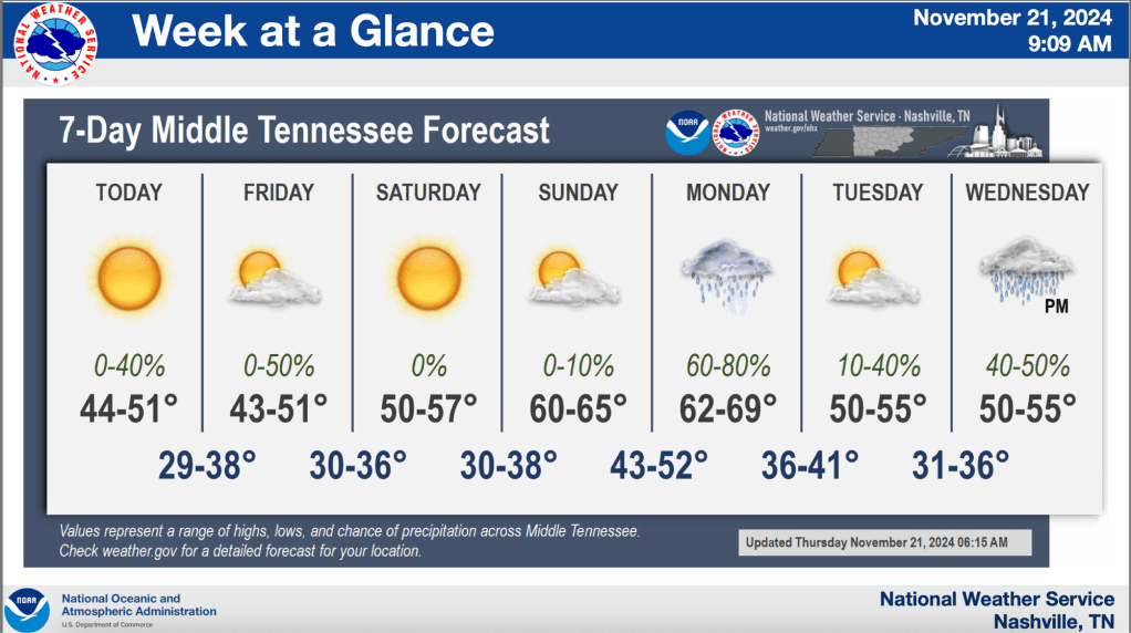
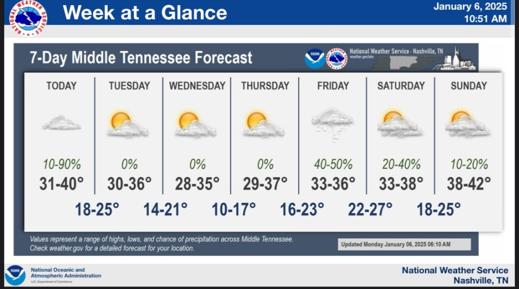
And here’s what to expect for the week!
Good morning all! I’m sorry of the short notice on the upcoming event but I’ve been having migraines like the dickens lol.
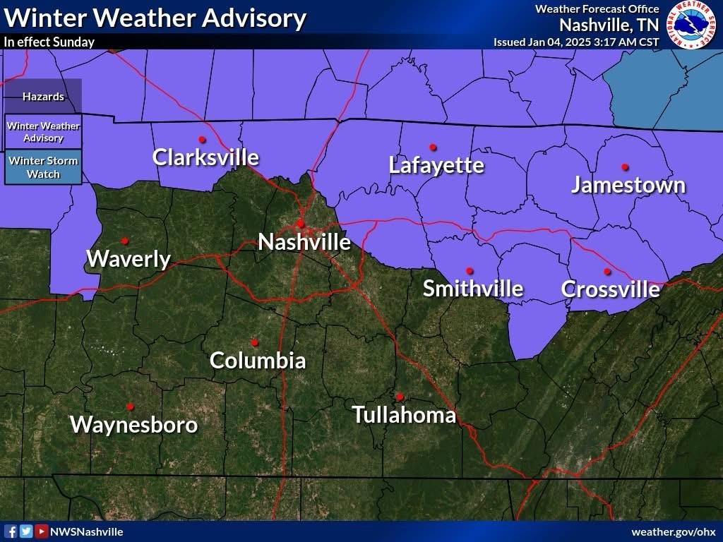
The northern half of the state is under a winter weather advisory due to the rain system coming in overnight.
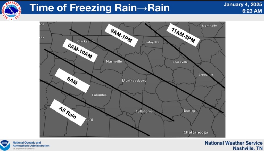
The timing for us is between 6am-10am. We could see some freezing rain and maybe some flurries in the morning.
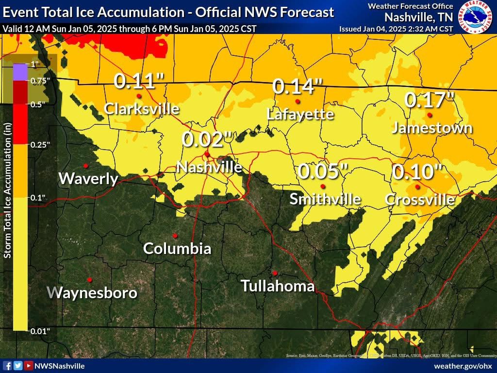
If we do have any accumulation it won’t be a lot. Just a little.
Thank you! And as always, check twitter, threads, bluesky and my Facebook page for up to date coverage
Good afternoon folks. We’re just one week away from thanksgiving and we do have the S word that has been mentioned in the forecast. Our area it is slim chance to see flurries. But it’s not zero.