NWS-Nashville #tSpotter Partner. VERIFIED/CERTIFIED Graduate Storm Spotter and WRN Ambassador for Rutherford County. Use #tSpotter to report to the NWS.
Severe weather for Saturday into Sunday
Good afternoon everyone.
We’re looking at the potential for some strong storm to come through this evening through the overnight hours.
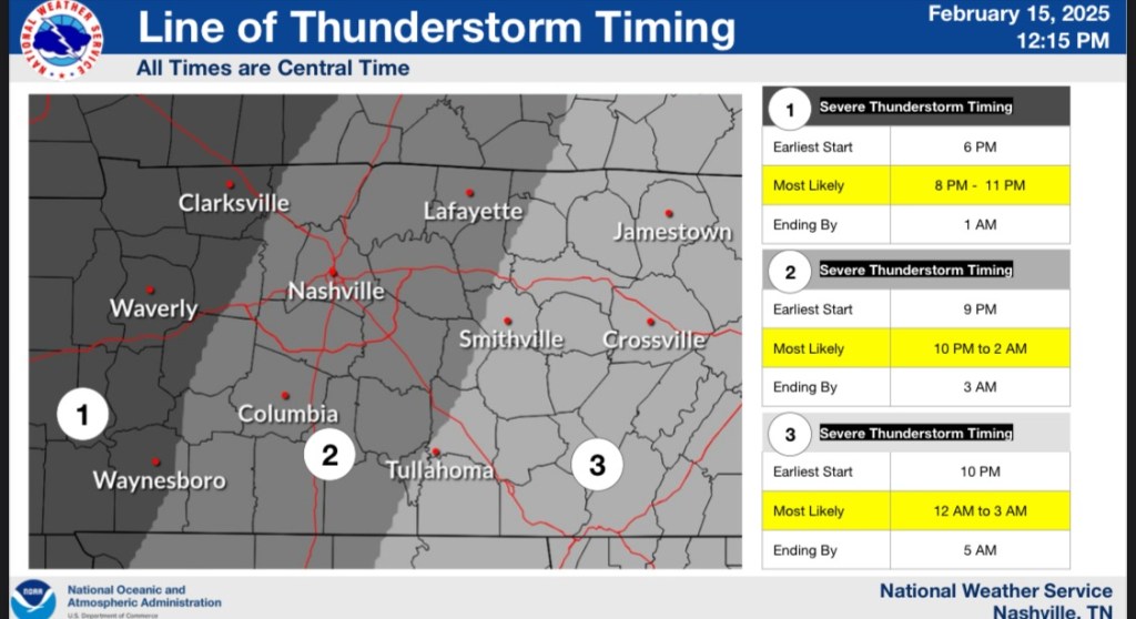
The timing of the severe potential for tonight. We’re looking around between 10pm-2am as the most likely time that our area will receive potentially severe weather.
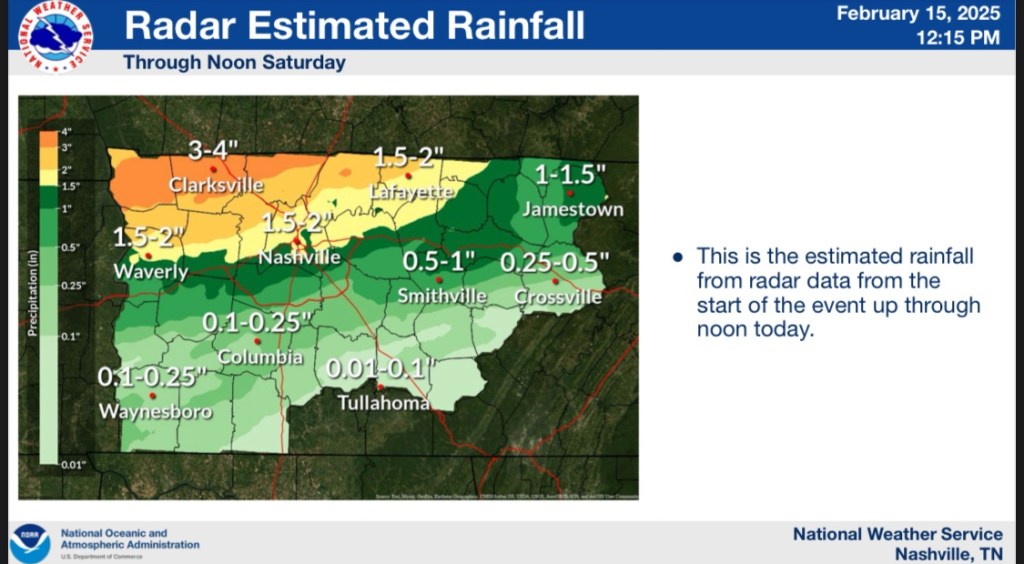
The latest threat for the rain that’s coming in is the flooding concerns. We’ve had so much rain over the past few days that the ground is saturated. We’re expecting another 1-2 inches of rain with this line pushing through tonight.
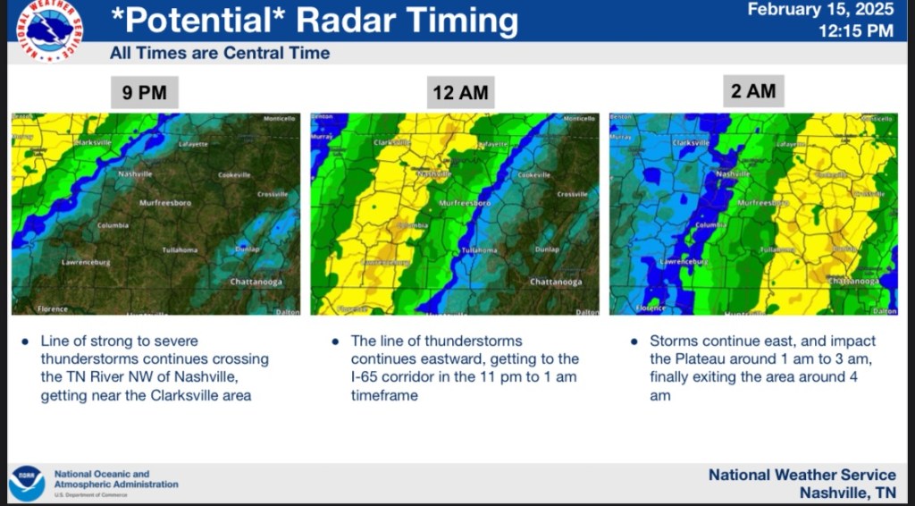
The potential timing of the rain moving into and through our area. These times aren’t exact. And they’re not set in stone. This is just an estimate. Like I said we can see another 1-2 inches of rain as the line moves through our area. Our area is currently under a slight risk for severe weather. We can see a possibility of 60-70mph winds as well as heavy rains and hail. There is a small chance for tornadoes so make sure you’re weather aware as this line moves through.